Monday, April 11, 2005


The Walk!!!


Heading Down


Wednesday night I headed down to Melbourne and met up with the rest of my team. Fortunately, their flight from Perth arrived just before mine, and our support guy, Kevin, was there to pick us up. He had even practised driving to the airport, having arrived exactly 12 hours before after confusing a "p" with an "a". Oh well.


After settling in for the night in a miscellaneous hotel, in a miscellaneous suburb of outer Melbourne (only after the Perthites failed to fully ajust to Eastern Standard Time), we got some sleep. Being without transport, we could only wait for Kevin to arrive the next morning for a course reccy (not that we had anywhere in particular to go).


We were able to see the start, as well as the first couple of checkpoints. All good and well, particularily as Kevin already planned a few of our breaks slightly away from the checkpoints, where he knew there would plenty of space for him to set up our resucitation table. Now we knew where to meet him.


That night, we ate heartily and packed like a pack mule, whatever that is like. I was taking 2 pairs of shoes - a pair of trail runners and a pair of sturdy joggers. I was also taking 3 lots of 2 pairs of socks - 6 in total. Two t-shirts, plus a long sleeved one. A vest for warmth, as well as some wet weather gear, not that any rain was predicted (warm and dry was the forecast). A spare pair of shorts, and some spare reggies to boot. More than I'd need, but because I had the opportunity to take them, I would.

The Start

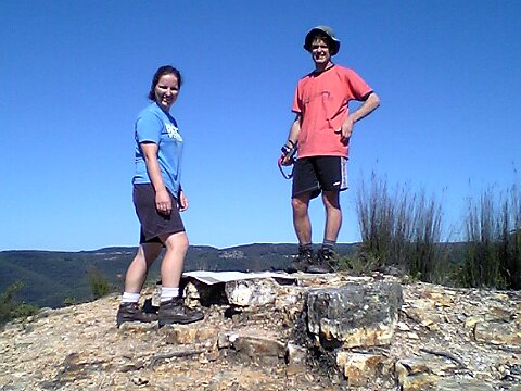
As predicted, the day dawned dry and sunny. Our lift arrived on time, and soon we had signed in, and were ready for the walk. We were starting at 8am, but only after we changed our predicted time to under 30 hours. About half of the 400 teams of 4 were starting at 8, the rest at 10. Teams who planned to start out running (such as the Gurkahs) were underneath the startline. We were about halfway down the snake, wearing our GRD Minproc t-shirts.


Eight am and we were off. The girls (Tanya and Kimbra) started at a brisk pace, a bit too brisk for Ian and myself. Still, we never got too far apart, although it may have reached a few hundred metres at times. There were no support teams allowed at the first checkpoint, but there was plenty of food and drink made available. We stopped for about 15 minutes before heading off.


The day was as predicted - warm and dry. Although the official temperature reached 30 in Melbourne, I never felt too hot at any stage. Thirsty, yes, but never too hot.
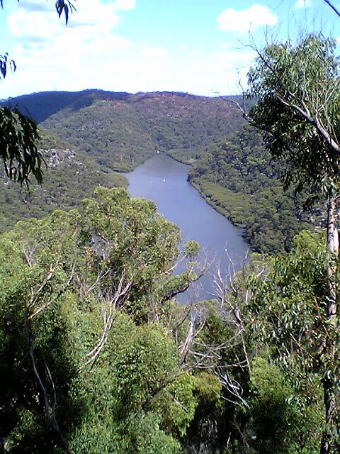
The walked continued towards Sassafrass, a genteel suburb in the Dandenongs. We had been walking at slighlty over 5km/hr - much faster than I expected - and I (well, Ian and I) were the slow ones! We negotiated our first big obstacle easily enough - the Kokoda Track Memorial (unfortunately, the evil influences are still present on the older signs, incorrectly labelled the Kokoda Trail. MESSAGE TO ALL: it is a track - a TRACK! It was even known by the diggers as "the track". It was only later evil (re American) influences that crept in which led to it be known incorrectly as a trail. When I go bushwalking, I walk on tracks - TRACKS! Or I bush-bash. Sometimes I walk on fire trails, but these are wide, designed for firetrucks to gain access to remote areas to fight bushfires - not what was in Kokoda).


So, after wandering up the Memorial Track - which was a fairly steep hill over a couple of kilometres, we had a break we guru support crew Kevin.

Checkpoints and Ressucitation

Overall, there were 8 stages with 7 checkpoints. Apart from the first CP (when there was no supporter access allowed), Kevin did a fantastic job, using his abundant experience of 5 trailwalkers (and 2 previous support crew badges) to make our walk as easy as possible. Each checkpoint, after carefully selecting an ideal spot (not always at the CP, but usually not far from one), we found a table filled with a smorgasbord of sports nutrition. Gels, bars, gatorade, protein shakes, plus boiled potatos (with extra salt), fried rice (with no peas), chicken, sandwiches and more! We would find 4 chairs around the table, enabling us to pig out without standing up. I believe this refuelling process allowed us to continue at a reasonable pace throughout the event. Well, it sure worked for me.

Darkness

I was surprised to reach CP 4 (or just after, where Kevin stopped) before dark. We had covered almost half the distance in under 12 hours - a very brisk pace. After another pig out, a change of clothes (although, by now I had already changed shoes and socks) we were ready to hit the dark tracks. Walking in night was much easier than I expected. For one, we were walking on well maintained firetrails. They had also placed glow sticks every hundred metres or so, meaning it was easy to work out if we were on the correct path (not that we ever got off track).
For me, the real part of the walk had just begun, I was looking forward to the darkness; I was curious to see how I would perform without much sleep; I wanted to feel what it was like to go non stop throughout the night. It was time.


No long into the night, I needed to change the batteries on my Pretzyl (the name I give to head torches). Being slightly rushed (we were still moving at a swift pace), I didn't quite read how one should put the batteries in. I thought I had lost a part of my torch, and it was never going to walk again. Luckily, we had a spare torch - a mini mag light, so I was not to be without photons.


By now, I had hit the Nurofen. My knees had started to ache a bit, along with my feet. I had already popped 2 blisters, and there were a few hot spots elsewhere on my feet. I was paranoid about getting massive blisters, so had changed either my shoes or socks at each checkpoint. I had also taped up a known hot spot (still got a blister there, though), and always double socked. Unfortunately, my orthotics (the old ones, not the new ones) managed to place extra pressure on one of the hot spots (the taped blistered one). Fortunately, by using normal soles, the pressure point went away.


As the night continued, the walking only got easier. We were now on the Warbuton Track, which used to be a railway line. Hence, it was wide, flat, and, well, easy. And it was long - about 30km long. There was a checkpoint about half way along, where we had a 45 minute break (which seemed much shorter to me). Here, we had to decide if we were to rest (ie sleep), or continue on. The consensus to to keep going - who wants to try to get going after some sleep? It was even hard to get going after 45 minutes...


By now our pace had slowed. I tried to keep up my spirits but relating random incidents from my primary school days to Kimbra, like when I got put in the black book in kindy for throwing a stick at David Stone (hit 'im just above the eye, too), or when Mrs Jenkins brought in her husband's skeleton (he was a doctor), and I wore the cranium like a skull cap...


I even started bursting out into song just before CP7. It was around 5am, and I was surprised at my enthusiasm. I had been taking a lot of Nurofen and caffeine, though...

Mt Donna Buang


We made sure to stay rugged up at our final checkpoint. It wasn't even in single figures, but fatigue always make you feel a bit colder. I felt a bit stiff as we started wandering towards our goal - the 1231m Mt Donna Buang. We were gradually climbing towards the base of the mountain, and the fact that we were almost home, and that it was at last starting to get light, made things a bit more bearable. I was carrying a bottle of coke and some glucose lollies, after hitting the sugar at the last checkpoint. Normally, you don't want to consume too many simple sugars in a long distance event, as you can experience energy lows following those sugars highs. Generally, once you start on the sugars, you should stay on them - hence the bottle of coke. And I was definitely on a sugar high. By the time we hit the start of the final climb, I was ready to start motoring along. First, after completing the lyrics to my new song "Donna Buang Rhapsody"*, I decided to really put the foot down. I started to catch a few of the teams ahead of us, and one guy told us there were some SES guys ahead, who had just walked down a little bit (maybe 4km) to drop off some water. I decided I wanted to catch them, and I was off.


There must have been a heap of teams just ahead of us, as I caught a lot of people. I caught the SES guy easily, and started making boisterous "Good Mornings" to everyone I passed. Not everyone appreciated it. Soon, I had reached the end of he climb, which was not the summit (which was the finish). I was still 3.6km from the finish, and I was also without my team mates.
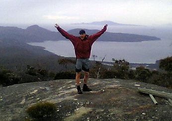
Fortunately, this was the perfect (and pre-arranged) place to wait. There were a whole lot of SES personel, a few chairs, blankets, and warm drinks. I immediately sat down, grabbed a blanket, and ordered a warm milo. And another. The people I overtook started to appear, and Kimbra soon popped up. W started to doze a bit, until Ian and Tanya materialised, adn we set off for the summit finish line. By now, 24 hours had just ticked over. We marched the last section together, and crossed the line side by side at 9:03, 25 hours and 3 minutes after starting. And about 10 hours ahead of our original schedule. Woo Hoo.

Finished


After posing for a few photos, we grabbed a small bite to eat. I think I had some soup, but by now i was sick of eating - I had been eating regularily for the past 24 hours. i should have eaten a bit more, to aid my recover, but we had finished, and I couldn't be bothered. The whole finish line was a bit anti-climatic, but most competitiors would have exited no long after they arrived, and with people finishing over a 36 hour period, you're never going to have too many supporters there.
The drive back took a lot longer than expected - I guess we had walked 100km. Eventually we were back - after Kevin stopped for a break (he too, had spent the whole night awake). I got first dibs on the shower, which meant I could hit the sack first. I rested well.

Thursday, March 31, 2005

Final Daywalk

I finished my training with a walk from Cherrybrook to North Ryde. This
was approximately 20km, (OK, maybe a little less). I ran a bit of the
way (maybe 5km) as I was a bit late. Overall, it took 3.5 hours.

Everything was OK gear wise - shoes with old orthotics, shorts and
t-shirt. Now for the real thing. I'll have to watch the following during
the walk:

* any hot spots on my feet should be tended to immediately
* likewise for any chaffing hot spots
* make sure I consume enough salt to avoid cramping
* enough carbs and protein to get me through the day, night, and day
again
* sore knees may require Ibuprofen, or knee braces
* wet and/or cold weather may present other challenges
* we should swap the lead, so no one is leading the whole time
* we need to stick together, which I may find hard to do

Fingers crossed!

Tuesday, March 29, 2005

Berowra Daywalk


This day's training was planned to mimic the Trailwalker, in terms of pace (actually, I expect our Trailwalker pace to be a bit slower), clothing (or at least foorwear) and backpack (spot on with this one), so what better place to do it than the Sydney trailwalker course.


I set off from Cherrybrook, and headed for Berowra waters, which is also the Benowie section of the Great North Walk, a walk from Sydney to Newcastle. I got dropped off at about 8:40, and settled into a brisk but manageable pace. I was planning to do the 25km walk in about 5 hours, so there were to be no bludge stops.

The day was already quite warm, and I was very surprised by the pleasant scenery, which followed the creek (the one that goes through Galstone Gorge) all the way, with only a few ups and downs, to get around the incumbant sydney sandstone cliffs that frequetly line creeks like this.

Most of the route follows a well worn track, but there were a few sections of fire trail. Harry the happy hiker always cropped up at major intersections to point me in the right direction, so there were no navigation dilemas (I didn't have a map - just a nose for the right direction).

A burnoff had taken place the day before, so I got to walk through a smokey section, for about 2km. There were still a few burning bushes about, and the haze seemed to trap in more heat. This section was closed by the Bush fire brigade, but I saw no sight of them that day, and ignored there warnings. But I could easily see it could have been unsafe - a few trees had collapsed across the track, and a few more were propped up by nothing more than a few twigs.

I crossed a creek, whcih was signposted as "The Fishponds", which ended up being some large, naturally occurring wells or holes (moulins?) gouged into the rocks by the water. Easy to see where its name came from.
I ran into a bunch of girl guides, out for some adventure. I hope they had a nice day.

Towards the end of the walk, a ran for a few minutes, to try and make up time so I wouldn't be late for my ride home. Unfortunately, he too was late, but fortuantely, a bunch of scouts were selling drinks at the Bewrora Punt (the walk ends on the west side, away from the shops), so I could refresh myself before we had a lazy afternoon.

Overall
* fantastic views along the creek, which is surprising for somewhere so close to sydney
* not much evidence of development, which is surprising for somewhere so close to sydney (a few roads to cross, but not much more)
* I should really treat the Trailwalker a bit like an Ironman in terms of nutrition, instead of waiting to get hungry before eating (I was starting to get a bit weaker towards the end of the walk)
* drinking from my Camelbak was just fine
* I won't wear my new orthotics, as they gave me a slight blister
* if I get sore spots in the trailwalker, they must be tended to immediately
* I need to do another long walk, using my old orthotics (the new shoes were OK)

Berowra creek widens near the Punt.

Berowra Creek - close to the city, and pretty!


Freycinet


So instead of three days high in the South West wilderness of Tasmania, we ended up in the picturesque, but populated Freycinet Peninsula. This area has experience tremendous gowth in the past few years, and sees a lot of tourist traffic. Fortunately, the National Parks seem to be regulated the flow reasonably well, and the local community has adopted a environmental mindset, eg by banning plastic bags from all their shops.

Dave piked, due to a dodgie knee, but Dan and I headed off, initially powering past the lumberers, despite our overnight packs. The view was pretty speccie, even though the weather was overcast. After some posing for the obligatory photos, we headed off along the beach. Sand obviously makes beach walking hard, but at least you don't have any hills to climb.

Away from the happy snappers, we enjoyed the trek up to Mt Freycinet, the highest point on the peninsula. The wind and slight elevation made it a bit cooler, but once we were out of the wind, headed towards our campsite, things became quite pleasant.

Our destination for the night, a very pleasant site by the beach, was much more populated than I expected. There were about 5 parties slung out by the beach, most of them probably on a 3 or 4 day walk.

That night, we made our aquaintance with some yanks from the site next to ours, who were all studying at Hobart Uni. And whilst on the beach, we copied the yoga moves of some girls from Melbourne. The late sunset meant we could enjoy some seaweed skipping
(!), rock throwing (I knackered Harry the Happy Hiker) and some Algae Glowing.


Algae Glowing


After dark, jump up and down right at the high point of an incoming wave (wait til the water subsides before you jump). Just after you jump, luminescant algae glow a bluey green colour, concentrated at the high water point on the sand. If you jump along the beach, you can see where the last wave rolled up to. Entertainment value 6.3/10.

Once we had enough of the beach, we returned to camp (all of 10m from the beach) for some dessert (dessert is spelt with 2 s's, as you always have a double helping of dessert), just in the knick of time. Possums had started to come out, and these ones were well and truly used to humans. The first one scared my by sneaking up between Dan and myself, despite being only 1m apart. She had her baby on her back, and Dan decided to pluck it of her back. The mother scampered away, whilst the baby dangled, limbs flagging wildy, until Dan dropped it.

We spent the next little while shoring up our food supplies, making them possum proof. Later, I heard about possums in this area unzipping tents and packs so they could gorge on some chocolate. Crafty little bastards.

The next morning, food intact, we set off along the coast. The seaside track was enjoyable walking, probably due to the fantastic weather. A pod of dolphins swam past, and we entered for a dip too.

The day was not very strenuous, which suited our tiring bodies perfectly. We made it back around lunch time, met up with Dave, and headed back to Hobart for our flight back home.


A perfect day on one of the world's prettiest beaches.

Why do backpacker ads have pictures of people with their arms in the air? Dunno.

This is as far as most tourists get - thankfully.


Day Walks - Tasman Peninsula, Mt Anne, Mt Field


After my trip to Frenchmans Cap, and a night in Hobart, I headed out to pick up Dan and Dave from the airport. (You can get cheap parking by parking in the rental car area - helps if you actually have a rental car, though.) We kept on heading to the

Tasman Peninsula, stopping at some of the many points of interest, including:
  • tesselated pavement (very square, looks unnatural)
  • the beach (cold, but much warmer than Ottawa)
  • Eaglehawk neck, where dogs stopped escaping convicts at the isthmus (and I broke some ancient driftwood in front of the cafe)
  • various blow holes and their relatives
  • Port Arthur (walk in the exit, and you don't have to pay)

We took 4 hours to visit the Totem Pole, a feature on my hit list (ever since I saw a picture of it in Climb Magazine - and there were climbers there too). 'Twas a nice walk out and back, with big cliffs, a bit of wind, and a seal (as discovered by Dave).

That night, we headed out to Lake Pedder (or Gordon) (seeing a numbat on the way), to get ready for our 3 day walk up Mt Anne. We camped at the track head, and the following morning I drove the car 7km to the end of the circuit (and walked back) to avoid a long road bash at the end of the walk. The morning was very overcast, but we were optimistic none-the-less. The walk starts across a swampy area, but before long, you are climbing up the ridge towards Mt Anne. Unfortunately, the cloud wasn't lifting, and we were steadily nearing its ceiling.

Eventually, at the a nice little hut, we reached that day's roof. There were a few others around, waiting for the weather to improve. One guy even ventured up for a bit, only to return speaking of crazy white stuff falling from the sky. Hmm.

After not much debate, we decided to pike, and returned to our starting point (now sans car). Fortunately, there were people (the climbers from the Totem Pole, actually) willing to give Dan a ride to the rental car.

Now with some unplanned days up our sleeve, we ended up at Mt Field National Park, an oft overlooked area, despite its spectacular alpine scenery. I was very impressed by it - much open heath, tarns, cliffs and scree slopes. The circuit we chose for the day went past an aptly named Lake Webster (Woo Hoo), as well as a couple of huts, one of which had been restored into a fantastic museum. The area is (during cold winters) a ski area, and we walked past a couple of the ski lifts, as well as some ski lodges.

Next, we headed for the coast, but only after we stopped at the Styx Valley, an area of environmental combat. The Tasmanian Logging Company has put up a nice walk going past the Big Tree, and the Bigger Tree, and explaining the environmental way in which they harvest timber. One kilometre around the corner, is Greenpeace's version of events, next to some clear cut land, with their walk visiting the big stump and Reg, the tree which protesters lived in until it got too cold (about April). It was great to see the contrasting messages and styles of propaganda. Should be more of it.

Friday, March 25, 2005


The Totem Pole, on Port Arthur (note the rope - climbers were on this) Posted by Hello

Port Arthur Posted by Hello

Some Archway on the Tasman Peninsula Posted by Hello

Wednesday, February 23, 2005


A Mad Mud Rush to the Top of the Cap


If you want to do lots of walking in Oz, then Tassie is the place to be. I was fortunate enough to have my good mate Dan go there with his brother, and invite me along.

I arrived 2 days before Dan and Mike, and made a beeline for Frenchmans Cap, which is about 30km from the turn off the Lake St Clair, and about that again from the west coast town of Queenstown. Another friend of mine had done this walk in 2 days, which is a basic out and back walk, with one night in a hut.

After crashing at my mate's mate's place in Hobart (I think I left my pack towel there - oh well, I have another and don't really use it that much anyway), I drove out to the Frenchmans Cap car park (which has warnings about vandals stomping on cars for no apparent reason - crazy inbreds), starting the walk around 10:30. The first few km are very pleasant, crossing the Franklin river, and then towards the Lodden River. The track is well formed, and despite a touch of rain, the going was easy. But that's where the fun started. Welcome the the Lodden Plains.

Sodden Loddens


Now for the next 5km or so, this flat and boggy area can be either incredibly draining, as you tackle what seems like and endless series of mud holes, or fun, if you, well, like puddles and puddles of mud (or, if you lucky, after very dry periods, you may be fortunate enough to walk on a thin layer of dried mud, and get through the plains generally unscathed). I really enjoyed, the mud, probably because:
a) I had never done anything like it before (even though i had traversed the Arthur plains - see previous bracket)
b) I like walking through nature plains, where you can see everything (unlike many Blueys areas)

Using my natural "mud" high, I raced through the Sodden Lodden, overtaking a couple of parties on the way. The plains eventually ended (aftrer about 5km and 2.5 hours), and after 5hours of walking since the car, I reached the first hut. Boy, what a nice hut. Pity I wasn't staying there (it had heaps of room, and a nice big stove).

Mossy Bastards


I pressed on, passing a pretty lake just after the hut, but by now, my natural high had started to wane. I was now hopping over damp and mossy logs and roots, and it wasn't the easiest. I was also starting to tire, and had a big hill to climb after reaching the end of the lake. The slippery bastard logs and roots didn't stop.

However, if you go up, it generally means you will get some place high, which generally means you will get to some place with a good view, and eventually I got there. The nice high views also often mean cold winds, and I got both.

Fortuantely, I had done most of the climbing for the day, and the rest of the day's walk had pretty good views (especially over lakes - I like looking over lakes). The hut I was staying in was next to another pretty lake, and although slightly smaller than the previous hut, it had mattresses on the bunk beds, and only 2 other occupants. Mattresses, and fuel, in a remote hut - how good is that! I slept well that night.

The Cap


I awoke for an almost early start, to head up to the Frenchmans Cap summit. If I awoke earlier, I would have got a whole lot more than the partial views I actually got from the summit. I could see the lakes below me, but not the horizon. Damn - I had heard stories of others who had summited several times without ever getting a view. At least I could see plenty from just below the summit.
My side trip to the Cap and back took about 2 hours, including farn-arkle time. But I still had another full days walk ahead of me.

Of the other parties on the track, I was the only one doing the trip in 2 days. Most were walking for either 3 or 4 days, and were surpised I was doing it in only 2. The weekend was also a long one in Hobart, so that may have added slightly to the numbers, not tht tthere were that many people on the track.

I enjoyed better weather on the way back, running into all the people I met previously, plus a few more. Everyone seemed to be well prepared for Tassie bushwalking, including the Austrians I met. I spent a very relaxing 45 min lying in the sun for lunch, but somehow the mud wasn't as enjoyable as the day before. I guess a) was no longer relevant.

Mud Walking Techniques


1. When you start walking in the mud, you try to avoid all of it
2. When you realise how much there is, you start to walk in some of it
3. When you are pretty dirty, you start walking throuigh it
4. When you step in a really deep section of mud, and it takes you some time to retrieve your foor, you start from step 2 again

Boots with gaiters are essential for easy mud walking. Waterproof long pants also help a lot. Plastic bags as gaiters don't work too well, nor do bare feet (note for dumb arse Dutchies).

Idiots


Just before I got back to the car, I ran into one last party - two Dutchies on an Aussie Adventure. They had been walking for only a few km, and hadn't yet reached the mud. They had obviously heard about "the mud", and asked me if they had been through the worst of it, holding up a muddy plastic bad which must have been used as some sort of make shift gaiter. I must have looked puzzled, as I didn't even remember any mud in that section (there was a tiny bit there, though). Their packs were overloaded with orange cordial and nice clothes, and had obviously heard about the "free" huts in south west Tassie. A 10km walk to the first hut, is not an easy walk! She even asked me if I thought she could walk through the muddy sections in bare feet. I replied "No". Repeatedly. Stupid people. I don't think they even had proper maps. Maybe they got buried in the mud...

Back at my undamaged rental car, I calculated I had been going for 8 hours on Saturday, and 11 hours on Sunday. I had taken me 1 hour extra from the hut on Sunday - as I was quite exhausted. An enjoyable weekend trip.


The "Sodden Loddens" - 5km of mud bashing.The Lake near Frenchmans Cap.

Frenchmans Cap Posted by Hello

Top of the long, mossy, rooty hill Posted by Hello

Tuesday, January 25, 2005


Kanagra - Kowmung - Church Creek Trip Report


So, first on the agenda was a weekend walk. I wanted to return to the Kowmung area, in the Kanagra Boyd National Park, as I hadn't been there for some time, but knew the area quite well. Two good friends, Grace and Dunk, were joining me for their first experience of the Kanagra wilderness. Excellent.

I planned to camp at Church Creek, on the Kowmung River, which I later worked out I had camped their about 7 times previously. No doubt because it is a nice spot, and not far from the Church Creek caves, which are easy to explore. I also planned to camp the first night at the Coal Seam Cave, which meant we had about an hour's worth of night time walking - which makes navigation a whole lot more difficult.

So, after getting picked up by Dunk outside work (a first, since Dunk never used to have a car), we were soon on our way. We arrived at the empty car park well after nightfall. I was expecting others to be in the car park, but Summer mustn't be the most popular time for over night walks around there. In fact, it was my first summer walk there, even though I have camped there many times in Spring, Winter and Autumn.

Setting Out


Anyway, we set off in the dark, and tried to imagine what the views were like from Kanagra Walls. You could make out some features, like the basic shape of the Thurat Spires, but it was a dark night, so it was something the Kanagra Virgins had to imagine. Despite a lack of light, it was very warm, and I managed to lead us through the maze of tracks and rock platforms to the right direction. It is amazing how indistinct the track becomes at night, especially since how much of a no brainer it is during the day. Probably because there are no trees around this section, just rocky areas and heath, and it is quite easy to miss the track when on the rock platforms.

Once the taller trees arrived, the track was much more distinct, but it was still tricky walking. I found I had to concentrate on walking when I was a the front of the group, but could day dream when I was at the back. We arrived at Coal Seam cave just after an hour of walking, and quickly setup before heading off to sleep.

Camp Caves


Now, if you have ever camped in a cave - a camp cave - which are more like overhangs at the base of a cliff with large flat areas to sleep on, you'll know how easy it is. No tent or tent fly to setup, and heaps of room to chuck all your stuff. If it rains - you don't get wet, and even your fire remains dry. I introduced another of my mates to camp caves, and he couldn't get enough of them - he always asked if there was a camp cave wherever we were going,

This cave had all the qualities of a good camp cave, and this particular night, it was also very warm. I almost didn;t have to get into my sleeping bag (this despite being at an elevation of about 900m).

We awoke the next morning to the cries of many birds - or one lyre bird. I made a fire for my porridge, and after a bit of farn-arkling about, we set off at a very relaxed hour, bumping into Mr Lyre Bird on the way.

Cottage Rock


Our first stop, after less than 1lm, was cottage rock, which sticks above the trees, giving you fantastic views down towards the Kowmung River. You can usually trace your route for your walk from here, which we did. We also pratised a bit of navigation, taking bearings and workiing out where we were by surronding features.

After almost heading down the Gingra track, we found Bullhead Ridge, and proceeded down it. At a spot just before Cambage Spire (a steep section, where once I was walking down there in a group with this girl who was afraid of heights. We all tramped down there with not much concern, but she burst into tears half way down. I couldn't really understand why, nor could I summon any encouragement - I just didn't get it...), yes, at this spot just before the cliffy bit, we turned off the main ridge, and bush bashed down to th creek. I was glad to get to the creek, as the steep sections were getting a bit tiresome.

The Creek


The canyon, or it is really a creek with some steep sides in places, was very very warm. When you stick your feet in most mountain creeks, you have to think about it, or look for an alternative (even if your feet are already wet). This was way too warm for that. Both air and water temps were probably around 30. By now, I had changed into some volleys, the number one shoe for walking in wet areas with (very grippy, even when wet, and the water exits your shoe just as easily as it enters). The local lizards were enjoying the warm weather, sunning themselves like lazy poms at the beach (although not quite as red). The local red bellied black snakes were also enjoying the warm weather, and proabaly also the lizards. We saw about 7 of these as we meandered down the creek, most of them were swimming, and they seemed quite adept in the water. I guess the tadpoles also had to watch out.

One section of the canyon was narrow enough to require a trickly climb around, although I ended up swimming it as well (just because I could). After lunch, we collided with Chrisy's Creek, just before hitting the majesy of the Kowmung River (HRH). We went to cool off in its waters, but we also happened to hit some shallow rapids just after a wide (say 20m) and shallow (knee high) and long (500m) section of the river. This all added upo to a very warm dip - never was it really quite refreshing, although it was fun to sit in the water.

The Kowmung


I managed to teach a lizard to swim whilst here, but we soon headed a few kilometres upstream to our campsite. Interestingly, a few sections on the river seem to have been home to a few very violent wind storms - most, or sometimes all of the trees (mainly casurinas) had been blown over, leaving us to jump the logs (and avoid black snakes).

After many pleasant river crossings (I kept on remembering when I did a walk here in the middle of winter, when you wanted to stay dry for as long as possible, and even when your feet were already wet, you didn't want to get them wet again), we made it to a nice clearing, beside the dry Church Creek (and wet and warm Kowmung River). We setup camp, jumped inthe river again (it was a bit cooler here), but that was not the end of our day's walking...

Church Creek Caves


After a scrummy meal, my plan was to find and explore the nearby Church Creek caves. The caves are about 1km up the dry creek bed, past a clearing, and not far from where the map indicates it is. Of course, finding a small hole in the dark from a 1:25000 map aint the easiest, even though I had done it before (except for the dark thingo). In fact, I have been to these caves 3 times before, and I have had trouble finding the entrance each time (except the first time, when someone else was leading).

Last time I went up, there was a big cairn in the middle of the dry creek bed, pointing to a tarak up towards the cave entrance. The time before that, I noted a big boulder, that looked like a brick (ie a square corner) next to the way up to the hole. This time, I found neither. We hunted around for half an hour or so, but if you ever get the chance to bush bash at night, one thing you will realise is that it is very hard - you can barely see 5m in front, let alone plan any significant way. Disappointedly, we trudged back to the camp site, and I eventually fell asleep in just my sleeping bag liner.

Next morning, with the enthusiasm of exploring unfound passages, we set off again to look for the caves. This time, after a few false starts (there are a number of holes up around there that don't lead to anything), we found the right passage, although I had to go down a fair way before I realised that it was "the one". (it was near a boulder that looks like a brick, only the boulder looks like a brick when you look at it from upstream, and there was no cairn, although we did add a hefty one when we left). (O, and there was a track up to a different hole, but if you head if to the false hole, then head back towards the clearing, for 10m you should be able to find the right place).

So, down Dunk and I climbed - Grace was to keep watch up top, on the lookout for melanomas, no doubt (i'm sure she would have slipped, slopped and slapped). Now, this cave system takes about an hour to explore (from my perspective), and it doesn't require ropes, so it is perfect for a side trip for those on a bushwalk. And it's cool in summer, and warm in winter. I hunted for invertebrates in it on the Great Kowmung walk of 94 or 95, but we din't find anything. I had also heard it contained a sump, with access to yet more caverns, but I had yet to see this. Dunk, having caved with ropes and all that, was keen to lead the trip.

We started heading up the creek (the system basically follows an underground creek), as I knew this path shouldn't take too long. We returned via a slighlty different way, passed the way back up to the surface, and then found the missing sump (although we didn't try swimming it). We continued on downstream - I was remembering some parts of it, but not all. The ground was quite dirty, but there were still many clean features to be had - flowstones, stalagmites and tites, glistening shit and the like - ask a sproglodyte for proper names. There were a few alternate paths to follow - all good fun. We eventually came to the tradition end of the cavern, but this time, Dunk found a passageway that continued on further, which I had never seen before. It looked like with all the dry weather we had been having, the creek had dried up a bit, leaving a very low (commando crawl territory) passage way to somehwere,. As we had been down for almost an hour, and we still had to walk up a very big hill, we piked on the mysterious, uncharted passage way, and found ourselves some proper photons. I think we were under for an hour ten.

Climbing Back


Reunited with Grace, we headed back to our packs to start the return journey, which was the same way we came (after deciding it was the quickest way back, since our caving took a bit longer than it should have). Except, of course, we didn't go up the canyon/creek, but stuck to the track. But it still meant we had a big hill to climb, complete with Cambage Spire (the crying girl cliff), which Grace made up with much poise, and, er Grace. We spied a pair of Red tailed cockatoos on the way back, and they must have had a nest nearby, as they didn't run too far from us. We managed to watch them for a few minutes, even after trying to scare them...

Back up to the tops (Kanangra), we found ourselves in some clouds. And with the fading light (actually, I think it was just the cloads that made it dark), no views were to be had. This was a bit of a disappointment for Grace and Dunk, as they never got a really good view from the walls. I guess they will have to return.


Dunk and Grace on top of Cottage Rock. "You can see everything from here!" Posted by Hello

The morning after a very pleasant night spent in Coal Seam Cave. Posted by Hello

Tuesday, January 18, 2005


Walking 100km


I've entered the Melbourne Trailwalker, a 100km walk around the outskirts of Melbourne, with my good friends Tanya and Ian from Perth (whom I met in Canada, not having been to Perth yet), and one of Tanya's colleagues. It's organised by Oxfam, and its intention is to raise money, probably for the Tsunami, but whatever it is, it'll be for someone in need.


We all have to walk the 100km, and we have to do it in under 48 hours. I hope to finish it by dusk on the second day, but I'd really like to finish it without sleeping. Tanya is organising it (thanks honey!), and her work is putting up some of the costs for us (travel and accomodation - thanks MinProc).

I intend to use this blog as a place to put my training walks, much like I did with the Ironman. Hope things work out!

Monday, January 17, 2005

Well, it's been a while since my last post, but I'm back! (maybe not with any vengenance, though). Anyway, after a year in Canada avoiding work (the wages are too low) and realising that Canadians can't run too fast (6th in the Victoria Half Marathon, in a time 1 minute slower than what I did in Sydney one year, but with more competitors), the reality of work is back. So too are the small stress fractures in both legs (last had them before I went to Maui for the Xterra Worlds). Anyway, I hope to put them behind me, as I get back into training, albeit gradually. I just have to make some time...